Kauai From Above


On our first full day in Hawaii we took a flight tour of the island with Jack Harter Helicopters. It was definitely a highlight of the trip and gave us a feel for the layout of the island. Ian was our pilot and he was equally informative, capable, and entertaining. We were in a Hughes 500 which seats 4 passengers plus the pilot and is flown with doors off so that there is no pesky glass impeding the sights and breezes of the island. Despite the helicopter flying at 100-120 mph, we were surprised that is was not as cold or rough of a ride as we had expected. Here are some of the beautiful things we saw from above.

Our first view after taking off from Lihu'e Airport on the east side of the island. This is looking south toward Poipu just beyond that mountain ridge.

THIS is Kalapaki Bay, where we stayed for the second half of the trip. In fact, we stayed in one of the homes you see here on the near side of the bay. On the right is the beautiful Marriott Resort where we were able to enjoy the pool, beach, and restaurants, plus some stand-up-paddle boarding in the lovely blue waters of the bay.

A look back at Kalapaki Bay, the Marriott, the Lihu'e Airport, and on up the east shore toward the Napali Coast.
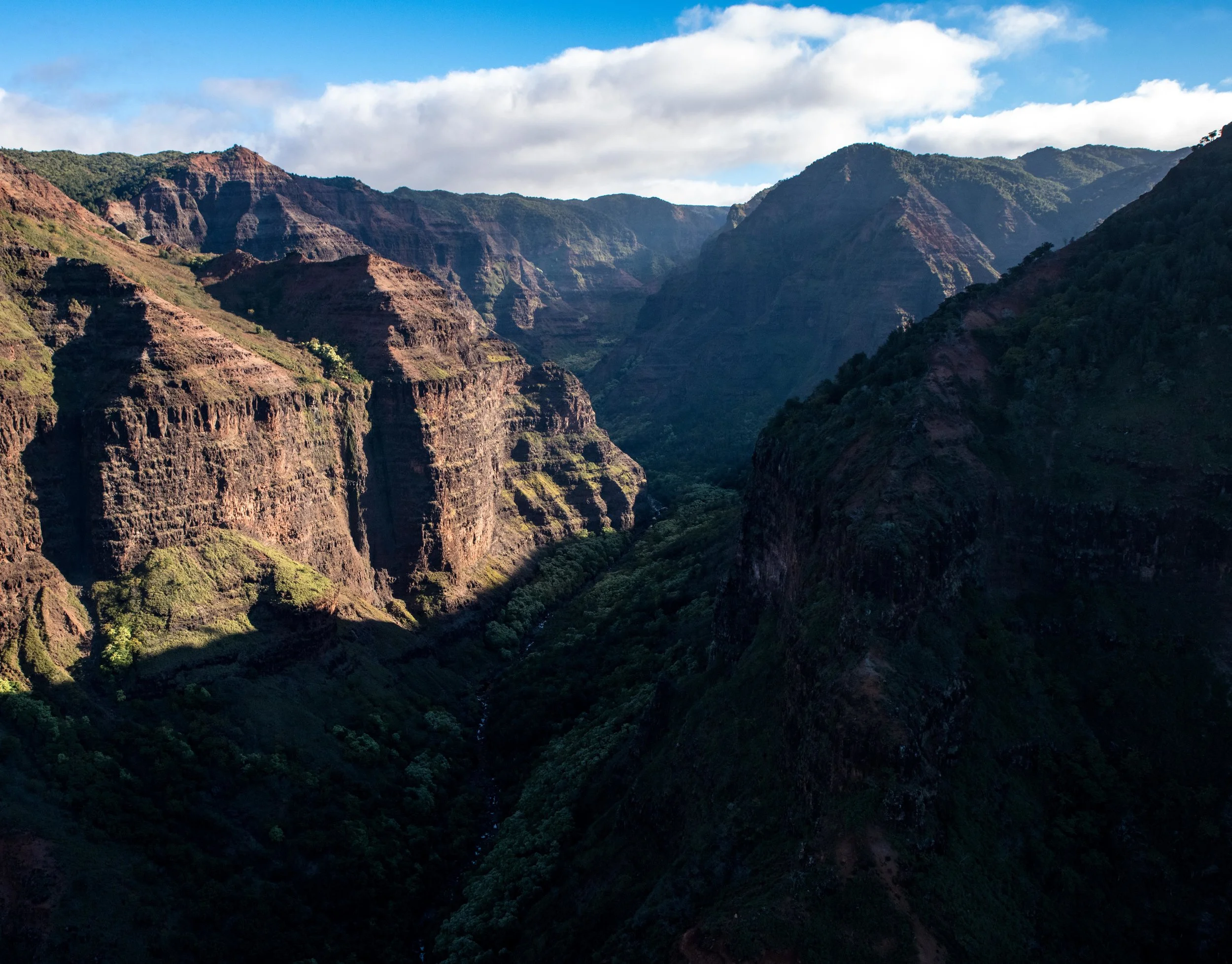
As you fly across the midwest portion of the island you see land like this: deep brown/red canyons spotted with rivers and waterfalls. Most of this land (roughly 50,000 acres) is privately owned by the Robinson family who used the flatter portions for sugar plantations and the rest has remained wild. A portion is also owned by the state and is home to Waimea Canyon State Park, which I wrote more about in a previous post.
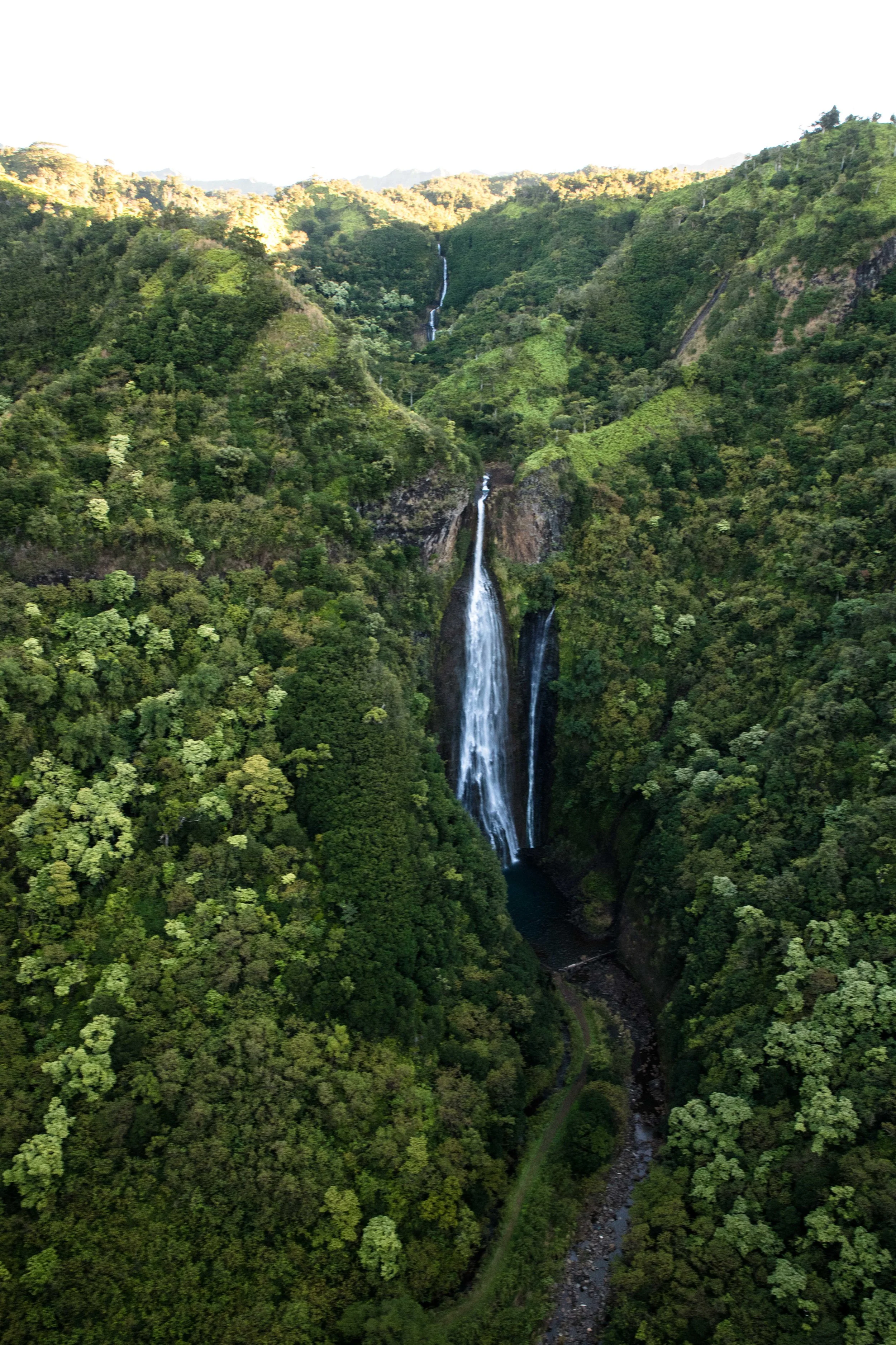
This is one of the falls on the Robinson Family land, and is famously the falls that appear in the opening scene of Jurassic Park! It can only be reached by helicopter.

Behold, the rugged and beautiful Napali Coast. She sure is a stunner. And no wonder it has stayed undeveloped given the terrain. The only real way to get there is by foot, most popularly on the 11 mile Kalalau Trail.

If you recall from an earlier post (which you can find here), we were planning to hike the Kalalau Trail but opted not to due to weather. Here's a look at part of the trail we would have walked. See that line running right across the middle of the cliff face? See those crashing waves below? Not something I would want to tackle in wet, slippery conditions.

Turning back for one last look up the Napali Coast.

Coming from the Napali Coast and looking south.

Looking down at Haena Beach.

Once beyond the Napali Coast, we turned inland, to the lush and vibrantly green ridges around Mt. Wai'ale'ale - the second wettest spot on Earth with more than 450 inches of rain per year.

Mt. Wai'ale'ale is a partially collapsed volcano and this is actually one of the INSIDE walls of what remains.

Next time you're in Kauai, I highly recommend spending the money to see the island from above. It is an experience unlike any other. Thanks to Jack Harter Helicopters and Ian for a morning well spent.